
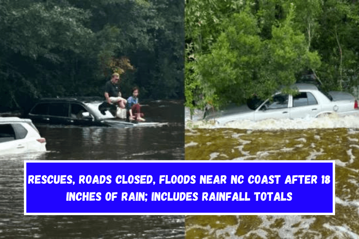
WILMINGTON, NC. — Monday’s torrential rain and high surf caused considerable flooding along the North Carolina coast due to Potential Tropical Cyclone 8.
Brunswick, New Hanover, Columbus, and Bladen counties had flash flood warnings, and scores of coastal roads, cars, and businesses inundated.
The Sunset Beach Police Department in Brunswick County reported “extremely heavy rain” in various areas. Important routes including U.S. 17 in Brunswick County and 74/76 in Columbus County were closed.
Radar showed 18 inches of rain at Carolina Beach and 13 in Brunswick County.
At least 4 feet of water covered Lake Park Blvd near to Carolina Beach Lake Park in New Hanover County, prompting a declaration of emergency. A vehicle was abandoned in deep water.
The American Red Cross provided a shelter at Carolina Beach Recreation Center at 1121-B North Lake Blvd. on Monday evening.
Before noon, the Carolina Beach Elementary School and twelve other buildings were swamped. In Carolina Beach, near Lake Park Boulevard, lawn furniture could be seen moving away.
Near Randolphville Road NE, U.S. 17 was stopped just after 3 p.m., and water rescues were going on. Also, U.S. 74/76 was stopped at NC 11 because of flooding.
Damage to the bridges over Duke Energy Canal and Dutchman Creek shut down N.C. 211 in Brunswick County.
According to the National Weather Service, water was up to the door handles of some cars stuck on U.S. 17 at 3:10 p.m.
Town cops in Southport say that a number of roads were also flooded or washed out. Southport police said that East Leonard Street between Jabbertown and Fire Fly was completely flooded and could not be driven on.
Around 1 p.m., the parking lot at the Brunswick County courtroom was under more than 3 feet of water.
North Carolina Emergency Operations Center released rainfall totals for Monday:
- Ocean Blvd at Carolina Beach: 18.32”
- 1 mile S of Snows Cut Bridge: 14.83”
- Sunny Point Military Terminal in Brunswick Co.: 14.59”
- Boiling Springs Lake: 14.16”
- Half mile N of Snows Cut Bridge: 14.01”
- Saint James (Brunswick County): 13.34”
- Abbington Oaks in Southport: 12.74”
- Mallory Creek at Leland: 6.78”
- Wilmington Airport: 3.61”
The Outer Banks were flooded all the way up to the north end of Ocracoke Island, which is part of Cape Hatteras National Seashore.
Officials said that the flooding was caused by a high tide and high surf warning that were both higher than usual.
For the rest of this week, Cape Hatteras National Seashore said, travelers should also be careful at the north end of Ocracoke Island during high waves.
On Hatteras Island, the north end of Rodanthe was dangerous because of building materials and parts of septic systems that were close to coastal structures that could fall.
As well, seashore officials say there will probably be too much water in the ocean in Hatteras, Buxton, Rodanthe, and near the tourist center for the Pea Island National Wildlife Refuge.