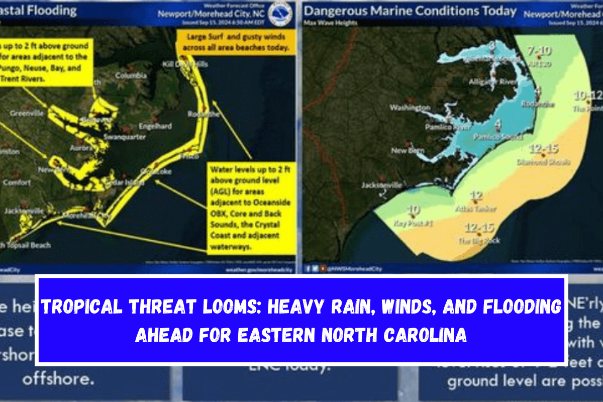
A tropical storm that is growing off the coast of the Carolinas will bring heavy rain, strong winds, and maybe even flooding to eastern North Carolina. A Tropical Storm Warning is in effect for the coast.
Tropical Threat Approaches Eastern North Carolina
The National Weather Service in Newport/Morehead City, NC has sent out a Tropical Storm Warning for Coastal Onslow, East Carteret, and West Carteret, as a possible tropical storm moves toward the area. The storm is about 200 miles south-southwest of Morehead City.
It is moving northwest at 7 mph and has winds that can reach 45 mph at their strongest. Over the next few days, this weather event is likely to bring heavy rain, strong winds, and coastal floods to eastern North Carolina.
Heavy Rain and Flooding Expected
Forecasters say it will rain between 3 and 7 inches, and even more could fall, especially in places south of Highway 70. In low-lying, urban, or places with poor drainage, this could cause flash flooding in certain areas.
Parts of eastern North Carolina, like Beaufort, Greene, Martin, and the Northern Outer Banks, are under a Flood Watch from Monday morning to Tuesday afternoon. People who live in these places should be ready for water levels to rise quickly and dangerous driving conditions.
Coastal Impacts and Rip Currents
Coastal areas can expect a small storm surge that floods 1 to 3 feet above ground level, especially near the shore and in low-lying areas. Small amounts of beach damage and overwashing by the ocean are also possible.
This could make roads near the shore unsafe. Mariners are told to stay out of the water because the conditions are too dangerous with strong winds and rough seas.
Tornado Threat Looms
Along with the storm comes the chance of a few tornadoes in eastern North Carolina. The risk is highest from Monday to Tuesday. Because tropical systems can cause tornadoes to form quickly, it’s important for people to have more than one way to get signs and be ready to take cover right away.
Preparing for Wind and Power Outages
Coastal places could start to feel the effects of tropical storm-force winds late Sunday night and last through Monday evening. Damage to trees and power outages are some of the things that could happen.
The winds could be strong enough to destroy porches, awnings, and sheds, among other things. Homeowners should tie down any loose items around their land and be ready for power outages.
Hazardous Weather Changes Fast – Stay Updated
The National Weather Service often changes weather watches, warnings, and advisories. Please keep an eye on your local news stations and NOAA All Hazards radio for changes to this story.


Leave a Reply